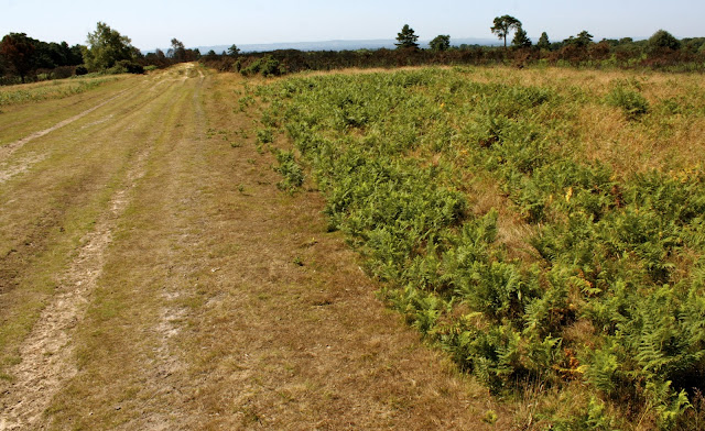
Yesterday Little dog and I went exploring on the Ashdown Forest again. We went to look at the site of something that I keep finding on the internet described as an ELG. These letters stand for Emergency Landing Ground which in layman's terms is an emergency runway for aircraft. ELG's were built on open areas of flat ground all over the south east of England and East Anglia during World War Two.
This particular one is adjacent to the A22 at Wych Cross (opposite the Llama Park) running roughly south to north on a slight rise in the ground. It was constructed by the Canadian Army who were stationed all over the Forest and surrounding areas during both world wars. A B17 (Flying Fortress) Bomber of the USAAF made a successful landing here on 6 September 1943 having run out of fuel after returning from a raid on Stuttgart. Two other B17's on the same raid also landed in the vicinity, one at Pippingford Park and one by the Ashdown Park Hotel.
The Emergency Landing Ground at Wych Cross looking South
Using an excellent leaflet that I got free from the Ashdown Forest Visitor Centre I easily located the site of the ELG. Unfortunately there is nothing left now to show that there was ever a runway here. The original construction would probably just have been made of graded earth, which has now returned to heathland, covered in gorse, heather and bracken. At the moment much of this heathland is blackened and charred after a recent grass fire, although new plant life is starting to appear.
In the Saxon calender 1st August was known as 'Lammas day'. This was the day when they began harvesting cereal crops and baking the first bread after a month of enforced fasting. Prior to the Industrial revolution most people in England relied on agriculture to survive. This leads me conveniently to something that I had spotted on the map marked as 'Marlpits' in several locations principaly at Fairwarp and Nutley.
Remains of a Marl pit at Nutley
Marl is a soil made up of a mixture of clay and calcium carbonate in the form of lime or chalk. I assumed wrongly, that it was used as a daub for the walls of medieval houses. It was in fact used as a fertiliser to enrich the sandy soil of the Forest and increase crop yields. These marl pits were used communally and located on common land. Treating the fields with marl was a very labour intensive occupation but luckily only had to be done once every twenty or thirty years.
Marl pit in woodland at Nutley
Many remaining marl pits throughout the country were quite deep and a lot of them were eventually filled with water and used as ponds, much as disused gravel pits are flooded today. The ones at Nutley however are shallow and partially covered by trees and bracken which as you can see from the photographs are not much to look at.
Whilst looking for holes in the ground at Millbrook, I spotted some more pillow mounds on the map. These are much larger then the previous ones and easier to identify. Unfortunately I couldn't get access as they are on private land near Old Lodge Farm. Luckily I had a long lens with me and managed to take some half decent photographs across the valley. As you can see there is a large circular mound in the centre and a straight one running down the hill on the right. Many pillow mounds were constructed on hills as they used the sloping ground for natural drainage.


No comments:
Post a Comment